
World Weather and Climate Extremes Archive

Latest news
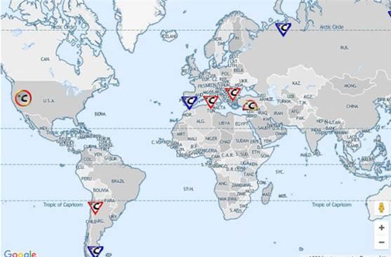
New WMO Extremes Category: Arctic Circle
GENEVA, 14 December 2021 (WMO) – A temperature of 38°C (100.4°F) in the Russian town of Verkhoyansk on 20 June 2020 has been recognized as a new Arctic temperature record by the World Meteorological Organization (WMO).
New Continental Antarctic High Temperature
GENEVA, 1 July 2021 (WMO) - The World Meteorological Organization (WMO) has recognized a new record high temperature for the Antarctic continent of 18.3° Celsius on 6 February 2020 at the Esperanza station (Argentina).
New Coldest Northern Hemispheric Temperature Record
WMO has recognized a temperature of -69.6°C (-93.3°F) at an automatic weather station in Greenland on 22 December 1991 as the lowest ever recorded in the Northern Hemisphere.
Disclaimer
The designations employed on this WMO website and the presentation of material on this website do not imply the expression of any opinion whatsoever on the part of the WMO concerning the legal status of any country, territory, city or area, or its authorities, or concerning the delimitations of its frontiers or boundaries. The mention of specific companies or products does not imply that they are endorsed or recommended by WMO in preference to others of a similar nature which are not mentioned or advertised.